
Directory

Search results

Published directory entries matching your search.

Search results

49 listings

The City of Sydney provides an open data hub where datasets can be browsed and downloaded as spreadsheets, KML or shapefiles. Maps can be created to visualise and analyse trends, and data can be accessed programmatically through the ArcGIS API for JavaScript. The data is freely available to everyone to use and republish without copyright, patent or other restrictions.

Dataset & Data Search 0
data-lmm.opendata.arcgis.com

Search a government or civic data catalog for reusable public information.

Dataset & Data Search 0
gis-midnr.opendata.arcgis.com

Open data portal depending on ArcGIS.

Dataset & Data Search 0

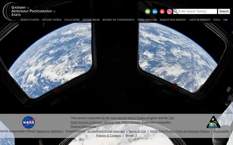
The Gateway to Astronaut Photography of Earth is a service provided by the International Space Station program and NASA's JSC Earth Science & Remote Sensing Unit. It offers access to searchable astronaut photography of Earth, including photo collections, ArcGIS Online resources, and latest International Space Station imagery, alongside tools and FAQ content.

Dataset & Data Search 0
geocommons.com

GeoCommons Archive is a community-contributed collection of open data from around the world, often sourced from public and open government websites. The searchable archive holds over 150,000 datasets as GeoJSON stored in GitHub, available to preview, download or explore in ArcGIS.com.

Dataset & Data Search 0

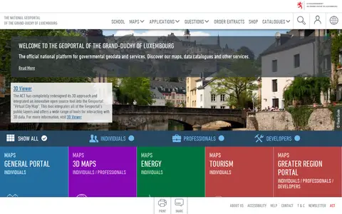
The national geoportal of the Grand-Duchy of Luxembourg is the official platform for governmental geodata and services. It provides maps, data catalogues, a 3D viewer and thematic portals, including energy, tourism, environment and the Greater region. Plugins let QGIS and ArcGIS Pro users search for a location, choose a basemap and add map layers or vector data.

Dataset & Data Search 0
hifld-geoplatform.hub.arcgis.com

The HIFLD Open Portal is an ArcGIS Hub platform that allows users to discover, analyze, and download datasets in formats including CSV, KML, Zip, GeoJSON, GeoTIFF and PNG. It also provides access to geospatial service APIs, enables analysis with charts and thematic maps, and supports creation of StoryMaps and Web Maps.

Dataset & Data Search 0
data-kalmar.opendata.arcgis.com

Open data portal depending on ArcGIS.

Dataset & Data Search 0
opendata.go.ke

Kenya Open Data is an ArcGIS Hub-powered platform that enables users to discover, analyze, and download datasets in formats including CSV, KML, Zip, GeoJSON, GeoTIFF and PNG. It provides API links for GeoServices, WMS and WFS, supports analysis via charts and thematic maps, and allows creation of StoryMaps and Web Maps.

Dataset & Data Search 0
gis-michigan.opendata.arcgis.com

Open data portal depending on ArcGIS.

Dataset & Data Search 0
data-mtfwp.opendata.arcgis.com

ArcGIS Hub site presenting Montana Fish, Wildlife and Parks GIS data for discovery, analysis and download. Data can be downloaded in CSV, KML, Zip, GeoJSON, GeoTIFF or PNG formats, and API links are available for GeoServices, WMS and WFS. Charts and thematic maps support analysis.

Dataset & Data Search 0

A National Centers for Environmental Information page presenting maps and geospatial products, including map viewers with data visualization tools and story maps combining maps, narrative text, images and multimedia. It also links to ArcGIS REST service directories for GIS servers with metadata and download formats for programmers and developers.

Maps & Navigation 0
gisdata.northlanarkshire.gov.uk

An ArcGIS Hub open data portal for North Lanarkshire Council. It offers data discovery, analysis and download in formats including CSV, KML, Zip, GeoJSON, GeoTIFF and PNG, with API links for GeoServices, WMS and WFS. Users can analyze data with charts and thematic maps and create StoryMaps and Web Maps.

Dataset & Data Search 0
ntgs-open-data-ntgs.hub.arcgis.com

The Northwest Territories Geological Survey Open Data portal provides a collection of geoscience information for the Northwest Territories. The survey, based in Yellowknife, formats the data for use in Excel, ArcGIS, and Google Earth.

Dataset & Data Search 0
dataportal-gotland.opendata.arcgis.com

Open data portal depending on ArcGIS.

Dataset & Data Search 0
opendata.minneapolismn.gov

Open Data Minneapolis is a platform that enables users to create custom initiatives by combining existing applications with a custom site. These initiatives can be used to form teams focused on specific problems and invite community participation.

Dataset & Data Search 0
unstats-undesa.opendata.arcgis.com

Open SDG Data Hub is an ArcGIS Hub platform focused on dataset discovery and access. It allows users to discover, analyze and download data in formats including CSV, KML, Zip, GeoJSON, GeoTIFF and PNG. The platform provides API links for GeoServices, WMS and WFS, and supports the creation of StoryMaps and Web Maps for data visualization.

Dataset & Data Search 0
osni-spatial-ni.opendata.arcgis.com

ArcGIS Hub site for discovering, analyzing and downloading data. It supports downloads in CSV, KML, Zip, GeoJSON, GeoTIFF and PNG formats, provides API links for GeoServices, WMS and WFS, and offers analysis with charts and thematic maps.

Dataset & Data Search 0
ottawa-riverkeeper-open-data-ork-so.hub.arcgis.com

An ArcGIS Hub open data portal from Ottawa Riverkeeper for discovering, analyzing and downloading data. Data can be downloaded in CSV, KML, Zip, GeoJSON, GeoTIFF or PNG, and API links are provided for GeoServices, WMS and WFS. Analysis is available through charts and thematic maps, with options to create StoryMaps and Web Maps.

Dataset & Data Search 0
data-sheffieldcc.opendata.arcgis.com

The SCC Open Data Site is an ArcGIS Hub platform that provides access to downloadable datasets in formats including CSV, KML, Zip, GeoJSON, GeoTIFF and PNG. It offers API links for GeoServices, WMS and WFS, supports data analysis with charts and thematic maps, and enables users to create StoryMaps and Web Maps using the available data.

Dataset & Data Search 0
gis-idaho.hub.arcgis.com

The State of Idaho GIS Hub is an ArcGIS Hub site for exploring authoritative data, maps, applications and tools developed by Idaho's State Agencies. It also helps users find and explore authoritative datasets that are part of the Idaho Spatial Data Infrastructure (Idaho SDI).

Dataset & Data Search 0
apps.esri.ca

Esri map showing Toronto live layers, city activity, services, and local geographic data.

Geolocation Tools 0
data-vaxjo.opendata.arcgis.com

Växjö Municipality Open Geographical Data is an ArcGIS Hub platform for geographic data. Users can discover, analyze and download data in formats including CSV, KML, Zip, GeoJSON, GeoTIFF and PNG, access API links for GeoServices, WMS and WFS, and create StoryMaps and Web Maps.

Dataset & Data Search 0